The Canary Islands sailing of the winter 2021-2022… where do I start! There’s lots to write about, and many photos and stories of the places we visited and friends we made. I hope you find some interesting things and get inspired to visit the Canary islands yourself after reading this post.
The passage from Europe to the Canary Islands
We arrived in the Canary islands after the late autumn weeks of sailing in Portugal and Spain. It was getting just a little too cold along the coast of mainland Europe, and the though of sailing South down to the Canary Islands became more and more appealing!
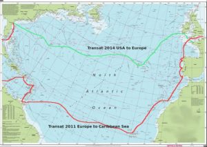
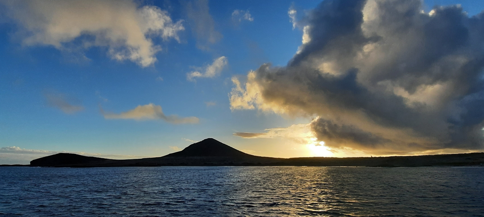
So, on Monday 13th December we sailed from Olhão, Portugal, and made landfall in the Canary islands at Tenerife and the city called Santa Cruz de Tenerife after 4 and a half days sailing from Faro on the South coast of Portugal. The 680 mile passage was interesting as it was more with Easterly winds than the typical Northerly which one typically sails down on, also known as the Portuguese trade winds.
On board we were 5 people, there was Marcel, from germany who is a paraglider, and he had his wings, and harnesses and other equipment with him. It’s quite a lot of equipment, and you don’t want it to get wet, so that was all stored under the saloon table. Mathilde, joined came on board just before leaving to sail down, she is from France and taking a long trip away from the french winter and her job. Also Maud, came on board at Olhão before leaving. She is keen on spending time on the ocean waves and wants to do sailing professionally at some point too. Also joining us for the sail down was Thibaud from Switzerland, and he had his touring bike with him, which he slept in the front cabin with. All in all I’d say we had a good full ship to sail with and to make the best use of the boat.
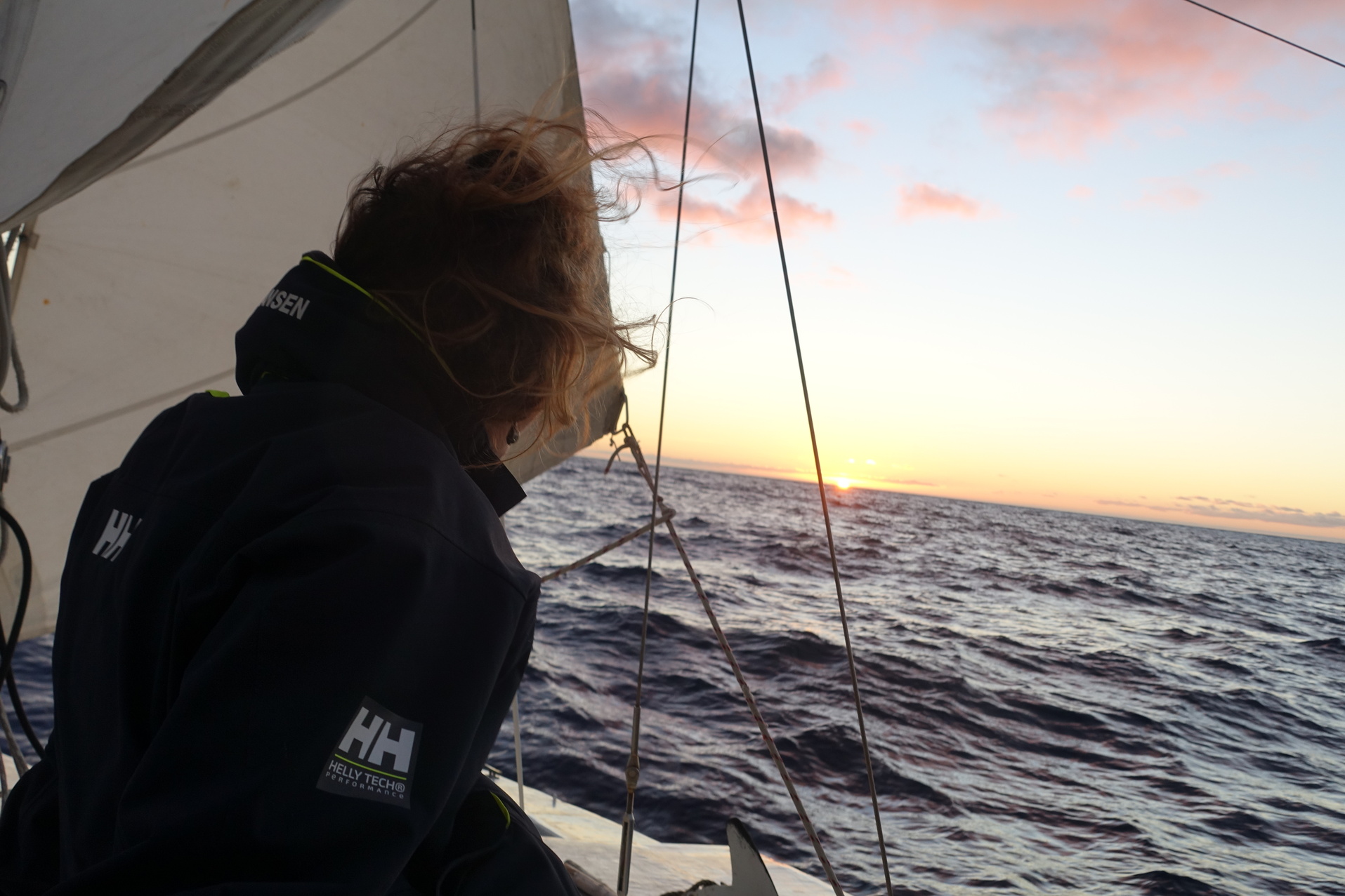
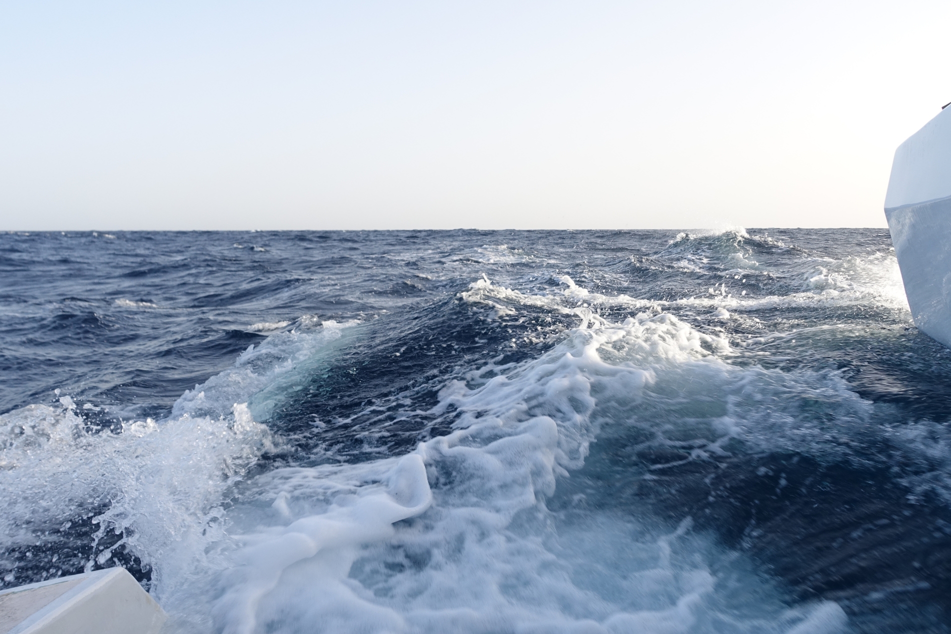
We actually had a really nice sail down, and mostly little to no swell. Only on one night did we have some thunderstorms to avoid, which we did quite easily by sailing further East than the direct route, for a few hours.
Anyway, this story is not about the sailing, it’s about the Canary Islands and the places we visited. It’s time to move on and for me two write about them now.
Tenerife: Santa Cruz
The first landfall after sailing from Portugal was Santa Cruz de Tenerife, and mostly just for resupply and as a good starting off point for the islands of La Gomera and La Palma. Now, with hindsight I think it was not the best place to make landfall. The contrast between the peace and routine of ocean sailing, and the chaotic semi-fake city of tourism and package holidays hit us quite hard. The feeling was made worse by the excessive christmas decorations lining every available street in bright neon lights. They really went to extreme lengths with the decorations, and I hate to imagine how much electricity all those lights used!
I was surprised how different the city of Santa Cruz was from what I remembered from my last visit, in 2009. My memory was of a greener city, with an amazing vegetable market and very good prices for produce. What we found was that the market was more expensive than the typical fruterias (fruit and vegetable shops) found on the side-streets around town. Also the city was much bigger than I remembered. Things do change of course… and it’s 13 years ago since I was there last.
To be fair; Santa Cruz has some fantastic parks, and old administrative buildings, and the likes – but it has a through and through emphasis on money and capitalism wherever you turn. One example of this are the park benches, which are financed by enterprises who do it because then they can also affix a publicity notice to the bench for all passers-by to see.
We quickly had enough of the town, and sailed South to a place called El Médano which is a peninsula on the South-east corner of Tenerife, and well known for its kite-boarding. Depending on the wind you can anchor on the Southwest, or Northwest side of the peninsula, and both bays have good holding in sand for the anchor.
The beat down there against the 25 knot South-westerly wind was very rough indeed, but we were a bit desperate to escape the town! Fortunately we achieved fantastic tacking angles and made good progress. This was thanks to the ocean current setting South at probably 1 knot rate. This current was helpful absolutely, but it also made the whole sail rather more wet and bumpy because the waves were much steeper than would usually be the case with the wind we had.
The main goal was to go to La Gomera, so we didn’t stay for long at El Medano, instead moving for a brief stop to La Calleta. We were going to fetch Marcel from the beach there, but with the swell he couldn’t swim out to the boat with his things. I decided to move back 10 miles to Los Cristianos on the Southwest coast of Tenerife. Los Cristianos is a good place to anchor because dinghy access can be made to the beach (at Playa de las Vistas), possible even with swell running. There is protection from the waves thanks to breakwaters, which have been constructed for the beach tourists. Supermarkets are close, and as is the airport Tenerife Sud.
The area has been nicknamed Little Vegas (after Las Vegas, Nevada) by us… because of the sprawling tourist entertainment avenues and offerings of all things unhealthy and expensive for the hordes of visitors on package holidays. We ended up doing our Christmas shopping there and then left for Vale Gran Rey, on the West coast of La Gomera. On board I had Marcel, Matilde, Maud, and Thiboud.
La Gomera: Vale Gran Rey
En route to Vale Gran Ray we anchored for a night at a small bay called Playa de Ereses. This place is very much cut off from the surrounding land, and is only accessible by climbing or by sea. There are a few abandoned houses there, and some water can be collected from the little stream when it rains. There were signs of old cisterns for this purpose, but sadly fallen into diss-use.
We did come across three men from Eastern Europe camping on the beach. They are the ones that told us that getting up to the village would require ropes and climbing equipment. They seemed to be quite comfortably settled in there in that peaceful place.
The coastline of La Gomera is in many ways like a smaller version of Grand Canaria. There are many bays like Playa de Ereses, which are good for anchoring when the direction of the wind and the waves allows. On La Gomera there are three principal ports, starting from Vale de la Gran Rey in the West, to Playa de Santiago on the South and San Sebastian to the Southeast.
Vale Gran Rey was pour first stop as I had information that it was a good set off place for hiking. It’s also a tranquil and pleasant little town, not at all like Los Cristianos!
A few years ago there was also an enormous landslide from the cliffs by the harbour. The cliffs must be close to 200 meters high, and there used to be a road going along the bottom of them. After the landslide there is little more than a path. As it happens a few camper vans seem to have got stuck down the road there, as it does not lead through to anywhere and ends at the little beach at Bahla de Argayal, or Argaga.
I found the harbour town of Vale Gran Ray to be very much the hangout of slightly off-the usual tourists, more like an alternative and family gathering point. Very overrepresented were the German travellers though. The evenings are very pleasant on the town square, where people gather in little groups and play music and drums, and watch the sunset. Only occasionally does the Guardia come by to instruct everybody to put their mask back on. The restaurants along the waterfront, meanwhile, are full of people eating and enjoying each others company – not a face mask to be seen.
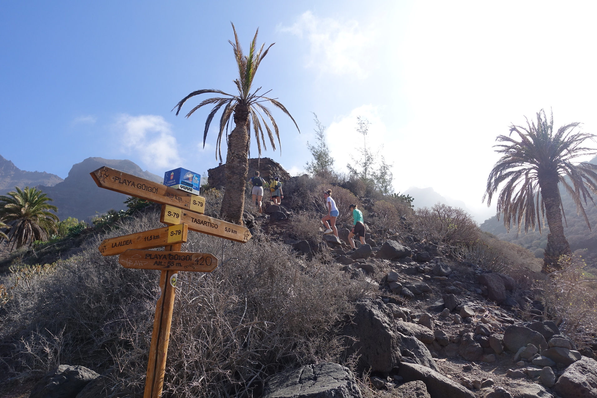
The Hiking up the gorge, from Vale Gran Rey
The route from the town of Vale Gran Rey, leading to the cove called Argayal/Argaga just South, is closed because of the landslide. You can still access it by jumping on boulders along the shoreline. It’s a just a little bit unnerving to look at the huge cliffs towering up just next to you… and to imagine how easily any part of them could start to come sliding down again!
From the beach there is a footpath that follows the Barranco Argaga up approximately 8 kilometres to join the GR132 hiking trail. We set off in the evening from the boat to go up to the top, and then climb down in an anti-clockwise route on the GR132, to thus come full circle and arrive back at the town of Vale Gran Ray. To break up the walk we slept in an area with old terraced plantations. and enjoyed the full moon, a good camp fire – and lots of food. It was Christmas also after all!
The GR route makes for fantastic hiking, and it is of ancient origins. One place in particular when approaching the pass at Lomo del Harinero is really epic. Cactus fruit everywhere, a smooth and pleasant path, the pass over the top of the mountain, and then the full view of the Vale de la Gran Rey. For us we are there alone in the morning light. The overnight camping has given us the edge and possibility of experiencing this place before any of the usual hikers are up in the hills.
Back to Tenerife: Los Cristianos
The big island of Tenerife was calling again, so after just the weekend in La Gomera we sailed back to the dear city of Los Cristianos and the hungry hoards of tourists. Very little wind for the 35 mile passage but we had luck with the sea state being almost completely flat. We didn’t stay long, but I had a crew change where Marcel and Thiboud got off, and Camille and Mirijam joined for the next leg to check out the South coast of Gran Canaria.
Before departure from Tenerife we took a day close to El Medano to see about some kiteboarding again. In fact… it was not the best experience, as it seemed like half of everyone in Europe was on the beach that day. Holiday season in full swing after christmas, of course!
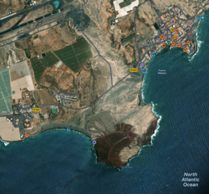
Gran Canaria: Playa Güi Güi
The first stop at Gran Canaria is an old legendary place called Playa Güi Güi. Legendary back in the days when it was one of the hippie pilgrimage destinations of the world, or so I’m told. As is often the case of the folk who did settle here, they have mostly moved on… but not everyone, I had the feeling that at least one house has the traces of these bygone days. A flourishing garden, and very homely and welcoming feeling where it sits in the landscape… music playing on a radio from over in the fruit orchard. It’s amazing how some love and care can make just a little bit of water go so far! Water is so precious in these areas, as rain is so rare for most of the year.
From the beach a trail goes up and over a mountain pass Degollada del Aguasabina, and then down into the valley of Tasartico. This is the only access to the beach, as there are no roads. The village of Tasartico does not have much more than a little church, some houses and two banana plantations. We had all the food and drinks with us and enjoyed a picnic there in the shade, only two small dogs in someone’s yard did not seem to appreciate maintaining the peace and tranquillity of the place… and they kept up their yapping for 2 hours. I think the neighbours got rather upset about the owners of the dogs not doing anything about the noise as they came by us gesticulating and rolling their eyes and saying things about perros.
We made our way back to the boat the same day, arriving at the beach just for sunset. After a full day’s hiking it is a real pleasure to relax with a swim, food, and sleep on board.
Gran Canaria: Mogan, Veneguera and Aguineguin
On our continued cruise on Gran Canaria we anchored at Puerto Mogan, Playa Veneguera and the old town of Arguineguin. At Veneguera we were planning on joining the New Year’s festivities on the beach, but due to the swell running on the beach we could not risk going ashore. We had our New Years celebrations on the boat instead, which worked out well. We had lot’s of food and cakes and a good time. A very unusual New Year’s celebration if you think about it: being stuck just off shore on a boat and rocking in the swell!
Fuerteventura: Moro Jable
Before going to Las Palmas, we sailed over to the Fuerteventura, 66 miles distant, where we stopped for a day. Camille left the boat there to join her family already on holiday on the island. The next day the rest of us then sailed over to Gran Canaria and the city of Las Palmas, again for some crew changes!
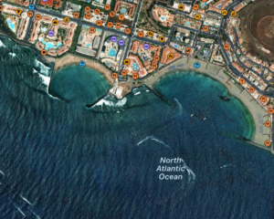
Gran Canaria: Las Palmas
This was the first stop for the boat in Las Palmas…. and Las Palmas is like no other place in the Canaries. It’s a big city, and there are a lot, a lot of boats here. There is mayhem in the anchorage, and the games of intrigues, seafaring stories, and cruisers hanging out with everything to do with boats and the Atlantic sailing season going on.
We ended up staying one week, anchored just off Playa de Las Alcaravaneras. We got stuck longer due to the bad weather, but then also some of the crew I had found other boats to continue their voyage South. We also all ended up catching Covid at the same time. Anyhow, Maud and Mathilde left the boat here, also Mirijam had to catch a flight to Germany, but two more lovely people happened to be in the area, Osama from Morocco and Naïma from Switzerland – then also Beatrice who is from Italy joined, she had found the boat online.
La Palma: Tazacorte
Our destination now was La Palma, where we sailed to the West coast port at Tazacorte, in total about 135 miles to sail, over the North of Tenerife, and we made the voyage in 36 hours.
We anchored for one night, and then had to take shelter in the marina due to the strong Southerly wind which blows here, by the name of Calima. We actually were unable to leave the harbour for 5 days due to the really strong winds! I heard that the word Calima in Arabic means word, or voice, or language… something like that. The wind which is called Calima is certainly very noisy, and very strong… after a few days of a storm like that everybody gets very tired! The boat is also painted from top to foot with fine red dust.
Instead of waiting it out on the boat, and having to listen to the whistling wind in the rigging, we took the opportunity to walk our legs off in the hills and valleys of La Palma. It is not far one has to go up in the mountains to escape the noise and most of the dust of the Calima.
Generally I was surprised about La Palma, I had always imagined the island to be large, and empty – but found that the island is a lot busier than La Gomera. There is plentiful productive agriculture on La Palma, and I think generally people have quite a good standard of living there. It warrants another visit, I would need to go back and explore the Northern parts of the island at a later date. As I said, it is a big place and because it is so mountainous it has an even larger surface area of course!
La Palma is dominated by the enormous ancient volcano crater called Caldera de Taburiente. Leading all the way down to the Southern tip of the island are a dozen more craters of varying ages. The most recently erupting was the 100 day eruption of Cumbre Vieja starting in November 2021.
We arrived to La Palma some 3 weeks after the volcano was declared to be still active, but no longer in eruption. We went walking close to the lava flows, which had grown the island of La Palma by some 4 square kilometres. Amazingly the new-formed rock was still hot! Apparently it can take months to cool off completely. Imaging the energy in all those millions of cubic meters of rock, it’s fascinating.
We made some other really amazing hikes on La Palma. There is an ancient volcanic crater which dominates the whole Northern half of the islands, and there are trails which go around the edge of the crater, or you can go inside. The nature is stunning, and the whole area is a National Park, called Caldera de Taburiente National Park. I found so many places that I would simply love to return to. One of them is the valley just North along the coast which leads up the Northern slopes of Caldera de Taburiente. The name is Valle de Barranco del Jorado, just before town of Tijarafe. It looked amazing, from the little I saw when passing on the bus.
They also have what is known as the ferravias which are paths along steep parts of the mountains, and to make them safe enough to pass down they have drilled screws into the rock and strung steel cables all along the path. These cables are for clipping on a harness, so if you should be unlucky and fall you cant go sliding down the whole mountainside. There’s a few of those which I would really like to go back and explore with some proper climbing gear.
So, finally after almost a week, the wind calmed enough in Porto de Tazacorte for us to safely leave the harbour. We then sailed to Tenerife again.
Tenerife: Garachico and Playa San Marcos
This visit in Tenerife we had the opportunity of stopping on the North coast at a town called Garachico. There is a marina there, or it is possible to anchor in a bay called San Marcos, which is just a little ways North of the town harbour. This is actually the only reliable anchorage on the North coast of Tenerife.
Here we had another crew change, where Naïma left the boat to see if she could find another was to sail down south the the Cap Verde. We had three new people join us though! Charlotte, Bets, and Chiara, from france, and italy originally. Osama decided to stay on board a little longer and sail with us to La Gomera again.
La Gomera: Playa Santa Catalina
I think one of the most amazing walks I did in the Canaries was this one, from the top of the island of La Gomera, all the way down to the boat at anchor at Playa Santa Catalina.
We did this as a one way walk, which was great. The cheating recipe was to take a taxi up to the top in the morning, but with 7 people sharing it I think it was worth while!
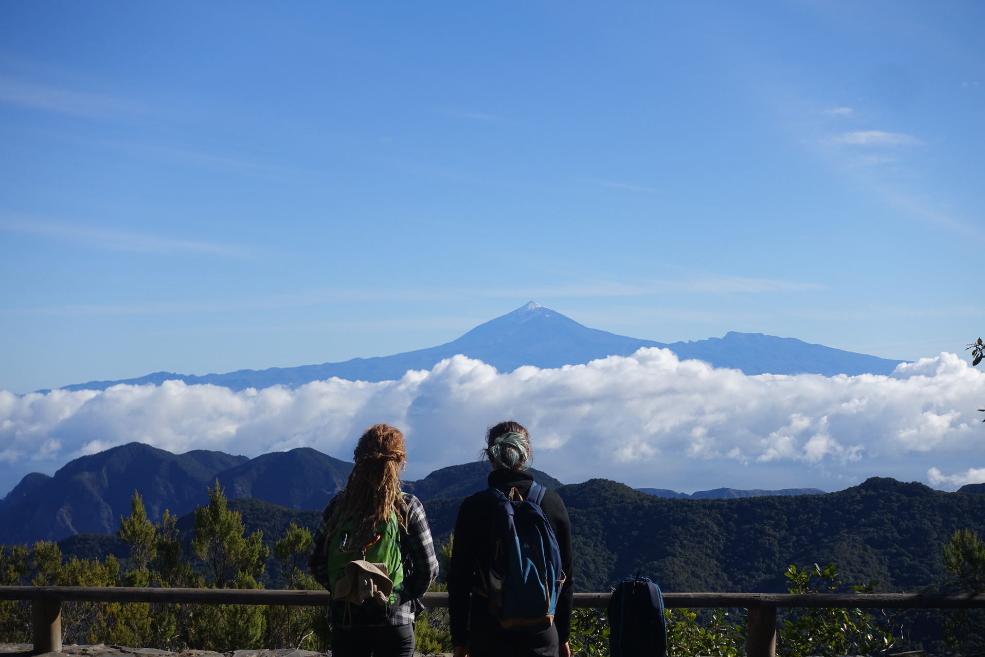
The first thing to notice is the views from the top of La Gomera. We had clear air, and calm, so we could see across to Tenerife and the volcano, the highest mountain in “Spain”, called El Teide.
The hike starts off in the ancient forests, which grow only at the higher altitudes. These forests are apparently thousands and thousands of years old, because the trees are quite small and staunted they have never been cut down. The rain is frequent and there are lots of streams and interesting hidden away places on these forests.
After about two hours walking it’s noticeable how the climate changes and is a little warmer. The path is generally in very good condition, and it seems to be an ancient thoroughfare as such. The foundations are solid volcanic rock, and steps have been cut into them where the mountain is steeper.
On the way down we passed small waterfalls, and little dams to make water storage for the long hot summers. The path winds its way all the way down the Valle de Hermigua, through what used to be small scale farming and where people lived, the views are fantastic all the while.
La Gomera: Vale Gran Rey
The anchorage at Playa Santa Catalina is not sheltered at all, so we moved around to the Western side of La Gomera to Vale Gran Rey again. This second visit to Vale Gran Rey we took it rather more easy, and did not set off on any major hikes. We had hoped for some chances to go surfing at the beach close to the town, but the swell was as flat as a pancake! At least this meant that we were very comfortable at anchor.
In the end we did not stay long at this second visit to La Gomera, but instead headed back to Tenerife as Beatrice needed to travel out from Tenerife’s airport. We sailed over and anchored at the town of Los Christianos again, the Little Vegas. This time it felt maybe not quite so crazy, and there were maybe not quite as many tourists as before.
From this place we decided to go back to La Palma, but instead of going to the Southwest town of Tazacorte we went to the town of Santa Cruz de La Palma. The idea was to look at areas to the North and see how hiking could be good there.
For this departure we made a special plan, where Naïma and Bets went very early in the morning for surfing at Playa de las Americas. Osama and I took the boat around the point later that morning and picked them up from the surf spot directly! It worked so well, and I think a few of the other surfers hanging out in the break were probably wondering what was going on seeing a sailing boat so close in shore.
In Santa Cruz de La Palma we took a birth in the marina, and each day we took the bus out to the North, to then walk back to the city. The marina is not so expensive, and it’s nice sometimes to meet other people on boats as you pass on the dock.
The walking was good, and the views beautiful as always. We did not really get out and away as far as could be possible, instead we did some quite easy walking and we did not sleep out on the mountains. We were also concerned about the leg of Osama, which if he does too much walking it begins to hurt him; it’s an old injury from his teens which bothers him.
Back to the East
Unfortunately we could not stay over at La Palma for very long this time, as I had been contacted for work and would have to find a safe place to leave the boat for one month. I decided that Las Palmas de Gran Canaria would be the best option in regards to safety and price, so we started the trip there. Before leaving Naïma got off, beacuse she is a cheese-maker and had found work on the North coast of the island for a month.
We did not go directly to Las Palmas from Santa Cruz de La Palma. Also we were lucky to find another crew (people from Belgium) who wanted to join, and we picked up Mathieu and Marguerite at San Sebastian de La Gomera on the way. We stopped for one night to anchor close to San Sebastian, and then picked them up in the morning from the marina fuel dock. The wind was then perfect for sailing over to Tenerife and Los Cristianos (again!) for getting some food. We also needed to wait for a good wind to sail over to Gran Canaria with.
Actually, this part of the trip was one of the best, we crossed over from Tenerife to Playa de Güi Güi on Gran Canaria. It is a beautiful there, and with a new moon and the dark starry sky it was such a magical place. We were lucky also because there was very little swell in the anchorage, and no wind. The sparkling bioluminescent algae in the sea, no light pollution, the sound of small waves breaking on the beach. It was just a lovely place to be, a peaceful corner of the earth far from everything.
This time at Güi Güi there was no hiking across to Tazartico, but we stayed two nights anchored, and then sailed around to the South coast of Gran Canaria. Again, another favourite place where we had already been once: Porto de Areguinguin! It’s a nice old fishing village, which has since expanded out into all the new hotel resorts along the sea, but the anchorage has still got a lot of the old feel to it. We stayed there for a night’s rest.
Continuing the next days we had really good luck with the weather, and could anchor outside many of the small towns on the East coast of Gran Canaria. This particular coastline is not really very interesting, but the towns have a very different feeling to them. I think it is because they are not involved with the tourism scene commonly associated with much of the Canary Islands. The people you see are mostly just the local populations, and the harbours are busy with local people who live there. You see no other sailing boats at all. We enjoyed seeing the daily town life, and watching people fishing from the peers, and kids jumping in and swimming in the harbour.
Fuertaventura, again
Due to the weather being so lovely, we decided to not sail directly to the big city of Las Palmas, but instead used the light Northerly breeze to cross over to Fuertaventura for a few days. I was keen on seeing the Sotaventos lagoon and the kiteboarding there, but also some of the more remote little coves and the possibility of good surfing.
Fuertaventura has such a very different feel to it from the other islands in the Archipelago. The beaches are the finest white sand, and the island is super dry. It really is the beach goer’s paradise, and also the best island for water sports generally.
We stopped at the little town of Puertito in the very South. It’s a special anchorage as to the Southwest there is a large reef extending out, and you can watch the spectacular surf breaking on it. There’s very little indeed on shore… but a few houses and along the coast one or two spots for the wave surfers to hang out.
We moved the 8 miles to Moro Jable after that one night anchored at Puertito. Moro Jable is again a place which we have already been, and it’s a favourite of mine. There’s some fantastic sand dunes which make the town very memorable. The town its self is geared towards tourism, but the buildings and the scenery is not too adversely affected by any big hotel complexes or the likes. We also sailed another 15 miles up the coast to Playa de Lajita. Suprisingly here the snorkelling was very good, and we had our devoted fisherman Mathieu on board, and he managed to hook a cuttle fish while swimming. I was very impressed!
To Las Palmas
Finally the weather report was showing the weather turning bad soon, and we left in good time to make harbour at Las Palmas on Gran Canaria before the strong wind arrived. Not only the weather was changing, I also had work starting in only a few days time and it was necessary to put Kelsall39 to bed for a month while I went away. We arrived at Las Palmas on the 15th February.
The plans had not worked out quite as I had hoped in terms of finding a space in the harbour marina of Las Palmas. There is a waiting list, and I had signed up on that. All the time I had been reassured that it would only be a matter of a day or two before I would have a place on the dock… but in the end my date of departure for my flight to London was the next day and I was still without a place in the harbour! Actually, it was to be another 8 days after I left that finally a space opened up for putting the boat, at which point of course I wasn’t around to move it.
Anyway, what we did instead was tie the boat to the marina wall, and put to anchors out, one to the Northwest, and the other to the Northeast. Many boats use this technique in Las Palmas, and this way the boat is quite safe. I was happy to leave her like that. Also, not only did we get the mooring place but Bets, who had been onboard for 5 weeks for the sailing, decided to stay in Las Palmas and look after the boat while I was away. It worked out very well in the end, and actually I even had help with sanding down the deck in preparation for painting.
Now, this text has already grown quite big, and I think I have forgotten lots of the details of all the sailing and exploring which we did in the Canary Islands. At least this is a little way of keeping memories written down for me and all the other people who sailed on board this winter! We were 17 different people onboard, and sailed more than 1000 nautical miles in the archipelago over a period of 2 months.
In the next post I will write about the passage North, all the way from Gran Canaria back to Portugal!
Hikes:
- Gui Gui on Gran Canaria across the top and through the mountain pass to Tazartico.
- Vale Gran Rey on La Gomera up the LR to the GR 132;
- From the top of La Gomera, down to Playa Santa Catalina.
- The three hikes of La Palma, and the valley to visit again next time!